Geography at Northwood

At Northwood Primary School, our geography curriculum is designed to inspire curiosity, deepen understanding and foster a lifelong appreciation of the world around us. Through a carefully sequenced, and progressive approach from Nursery to Year 6, we empower children to explore their local environment, understand global connections and develop key geographical skills.

We believe in making geography meaningful and accessible by connecting learning to real-world experiences – from simple mapping in the early years to exploring continents, climate zones, and natural resources in upper key stages. Our teaching promotes critical thinking, environmental awareness, cultural understanding which encourages pupils to ask questions, make comparisons and consider their role as global citizens.

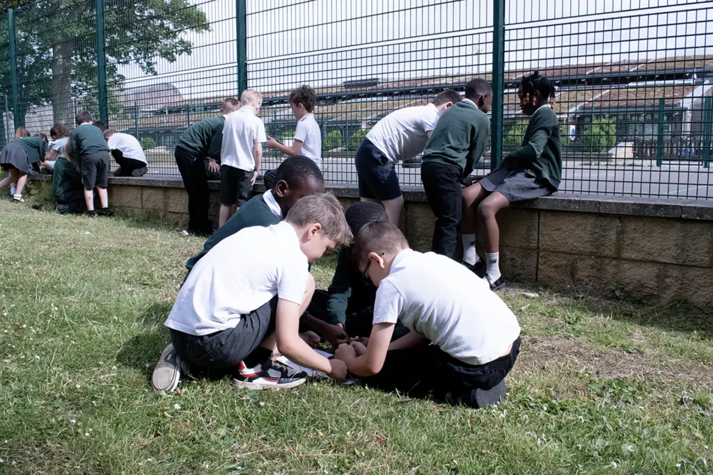
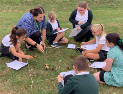
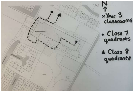
By integrating fieldwork, mapping skills and substantive concepts, we ensure that every child builds a strong foundation in geographical knowledge and enquiry. Our goal is to nurture informed, responsible geographers who are equipped to navigate and contribute to an ever-changing world.
Key stage 1
Pupils should develop knowledge about the world, the United Kingdom and their locality. They should understand basic subject-specific vocabulary relating to human and physical geography and begin to use geographical skills, including first-hand observation, to enhance their locational awareness.
Locational knowledge
- name and locate the world’s seven continents and five oceans
- name, locate and identify characteristics of the four countries and capital cities of the United Kingdom and its surrounding seas
Place knowledge
- understand geographical similarities and differences through studying the human and physical geography of a small area of the United Kingdom, and of a small area in a contrasting non-European country
Human and physical geography
- identify seasonal and daily weather patterns in the United Kingdom and the location of hot and cold areas of the world
- key physical features, including: beach, cliff, coast, forest, hill, mountain, sea, ocean, river, soil, valley, vegetation, season and weather
- key human features, including: city, town, village, factory, farm, house, office, port, harbour and shop
Geographical skills and fieldwork
- use world maps, atlases and globes to identify the United Kingdom and its countries, as well as the countries, continents and oceans studied at this key stage
- use simple compass directions (North, South, East and West) and locational and directional language
- use aerial photographs and plan perspectives to recognise landmarks and basic human and physical features; devise a simple map; and use and construct basic symbols in a key
- use simple fieldwork and observational skills to study the geography of their school and its grounds
Key stage 2
Pupils should extend their knowledge and understanding beyond the local area to include the United Kingdom and Europe, North and South America. This will include the location and characteristics of a range of the world’s most significant human and physical features. They should develop their use of geographical knowledge, understanding and skills to enhance their locational and place knowledge. Pupils should be taught to:
Locational knowledge
- locate the world’s countries, using maps to focus on Europe (including the location of Russia) and North and South America, concentrating on their environmental regions, key physical and human characteristics, countries, and major cities
- name and locate counties and cities of the United Kingdom, geographical regions and their identifying human and physical characteristics
- identify the position and significance of latitude, longitude, Equator, Northern Hemisphere, Southern Hemisphere, the Tropics of Cancer and Capricorn, Arctic and Antarctic Circle, the Prime/Greenwich Meridian and time zones (including day and night)
Place knowledge
- understand geographical similarities and differences through the study of human and physical geography of a region of the United Kingdom, a region in a European country, and a region within North or South America
Human and physical geography
- describe and understand key aspects of:
- physical geography, including: climate zones, biomes and vegetation belts, rivers, mountains, volcanoes and earthquakes, and the water cycle
- human geography, including: types of settlement and land use, economic activity including trade links, and the distribution of natural resources including energy, food, minerals and water Geography.
Geographical skills and fieldwork
- use maps, atlases, globes and digital/computer mapping to locate countries and describe features studied
- use the eight points of a compass, four and six-figure grid references, symbols and key (including the use of Ordnance Survey maps)
- use fieldwork to observe, measure, record and present the human and physical features in the local area
Pupil Voice
“I love using Google Maps to see the real world”
“I liked comparing what London was like in the past to what London is like now”